Wetlands – the climate control system of the planet
For centuries, people fought mires, bogs, and other wetlands, and in some countries, they won the battle… only to regret it soon! It turned out the peatlands have great value to the biosphere: from storing and filtering fresh water to regulating river drainage and supporting biodiversity. As the climate keeps warming, another globally important function of mire ecosystems has come into the limelight: peatlands are land’s largest storage of carbon
Today, when asked to name the gravest global threat, most will say COVID‑19 – and will be wrong. Despite the high mortality and the unprecedented social and economical ramifications, the spreading disease does not threat the very existence of humankind as a part of the biosphere. This cannot be said about global warming – the steady increase of the mean annual temperatures (about one degree Celsius per century), which has been observed since the beginning of the large-scale industrial development in the mid‑19th century.
Throughout the history of our planet, periods of global cooling interchanged with periods of global warming; there is a never-ending dispute on the reasons underlying these cyclic climatic changes. Possible factors here include astronomical processes, such as varying solar activity, and planetary processes, such as continental drift causing changes in oceanic currents, or high volcanic activity (Dobretsov, 2010).
")
However, the role of forest ecosystems in carbon deposition may be strongly exaggerated. As forests mature, their photosynthetic activity and productivity decrease drastically, to the extent of turning into carbon dioxide uptakers into carbon dioxide emitters (Duffy et al., 2021). This happens because of large-scale forest fires, which are becoming more frequent due to global warming (Walker et al., 2019) and other anthropogenic influences. For instance, 10 of 257 forests in the UNESCO World Heritage sites emitted more СО2 than they absorbed (UNESCO, WRI, IUCN, 2021)
In any case, in the past 600 thousand years, the climate of Earth has gone through several warming periods attributed to the so-called greenhouse effect – the increase of the effect of solar radiation due to accumulation of greenhouse gases in the atmosphere. These gases include water vapors as well as carbon dioxide (CO2), which can persist in the atmosphere, unchanged, for long periods, methane (СН4), nitrous oxide (NO2), etc.
The current global warming is accompanied by a distinct growth of the CO2 concentrations in the atmosphere. Over the past 70 years, its content grew by a third, the «extra» carbon dioxide being a result of human activities, and of the burning of fossil fuels in particular, as distinctly demonstrated by the isotopic composition of the carbon in the atmosphere. This disruption of the carbon balance was exacerbated by various anthropogenic influences on the biosphere, resulting in deforestation and pollution of the oceans, which are the key absorbers of carbon dioxide.
 – a conventional unit used for calculating carbon footprint equaling one metric ton of carbon dioxide. Based on data from Rhodium Group") In February of 2005, the Kioto protocol entered into force – an international treaty that relies on market mechanisms to regulate carbon dioxide emissions of the participating countries, including Russia. The Paris Agreement, another international treaty on climate signed in 2015 by 197 countries, became a further step in the control of the anthropogenic influence on the global climate.
In February of 2005, the Kioto protocol entered into force – an international treaty that relies on market mechanisms to regulate carbon dioxide emissions of the participating countries, including Russia. The Paris Agreement, another international treaty on climate signed in 2015 by 197 countries, became a further step in the control of the anthropogenic influence on the global climate.
The calculations underlying the the Kyoto Protocol and Paris Agreement account not only for the volume of carbon dioxide emissions for each participating country, but for its carbon uptake potential as well. Since discussions of ecological well-being of the planet seem to focus on forests, these documents only consider forest ecosystems, their surface area and carbon deposition potential.
However, forests are not the only and by far not the most important storages of carbon on land. There exist far more superior accumulators of carbon – peatbogs!
Carbon sinks
Any dead organic matter, from fallen leaves to dead century-old trees, begins to decay sooner or later, ultimately resulting in the release of the deposited carbon back into the atmosphere in the form of carbon dioxide. However, peatland areas with little or no access of oxygen organic matter fails to decay completely and accumulates in the form of peat. In temperate forests, the average span of the carbon cycle is about 150 years, meaning that in the scale of human lifespan, peatbogs trap it forever.

Occupying just 3 % of land, peatlands contain one third of all soil carbon, or 600 billion tons – this is twice as much as all the carbon deposited in the world’s forests (Scharlemann et al., 2014; Kirpotin et al., 2021). Only oceanic deposits hold more carbon. This makes peatlands the main storage of carbon in the Earth’s biosphere, along with the ocean. Moreover, that carbon is stored very resourcefully – in the boreal zone, with its snowy winters and short, warm summers, peatlands contain, on average, 7 times as much carbon per hectare as any other local ecosystem; in the tropics, it is 10 times as much (Parish et al., 2008)
. Photo by author")
At the same time, modern rates of carbon absorption in peatlands are relatively low and do not exceed 100 million tons per year (Parish et al., 2008; Frolking et al., 2014). It seems insubstantial compared to the emissions of carbon from burning fossil fuels, which are almost two orders of magnitude higher. Yet, the total volume of CO2 accumulated by peatbogs in the course of their existence could rise the global temperature by about 0.6 °C (Stöcker et al., 2013; Kirpotin et al., 2021).
The good news is, over 80 % of all peatlands globally remain in their primeval undisturbed state. The bad news is, about a fifth (around 650 thousand square kilometers, or 250 thousand square miles) have been drained and reclaimed (Joosten, 2016; Joosten et al., 2016) for construction, peat mining, agriculture, etc. This trend reached especially dramatic proportions in Europe: for instance, in Germany, the Netherlands, and Denmark over 90 % of peatlands have been destroyed; in Ireland, with its wet climate, 82 % of peatlands were drained (Tanneberger et al., 2017; Kirpotin et al., 2021).
. Left – distribution and zonation of peatlands and rivers in the Western Siberian Plain: I – polygon mires, II – flat-mound palsa mires, III – high-mound palsa mires, IV – raised bogs, V – flat eutrophic and mesotrophic mires, VI – reed and sedge fens and saltmarshes. Adapted from: (Liss et al. 2001; Kirpotin et al., 2021)")
One time, German biologists, while hosting their colleagues from Siberia, decided to show them their object of pride – one of the few remaining mires in Germany. They got into a cur and spent several hours driving around the place… but failed to find it. The bog mire had not disappeared – but it had become so small it was easy to miss from the road! A number of European countries, including Germany, have launched exorbitantly expensive peatland restoration programs, but their success so far has been very limited… (Bain, 2012; Peacock et al., 2018).
In the USSR, the war on peatlands was just as merciless as in Western Europe. By the end of the past century, about 69 thousand square kilometers of peatlands in the former USSR were drained and degraded (Bruisch, 2018). Luckily, the massive peatlands of Siberia remained virtually intact. This region, too, was subjected to intensive melioration; however, these peatlands were simply to immense for humans to cause them significant harm during this period. The severe climate of Siberia made the quest to meliorate its peatlands even more challenging.
«… will grow by Siberia»*
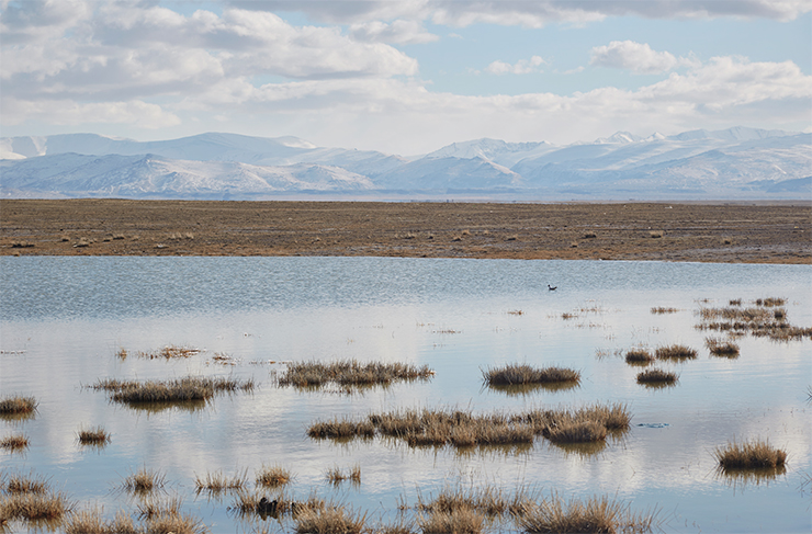
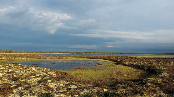
The largest paludified region both of Russia and the whole world is the West Siberian Plain, which spans from the Ural Mountains in the west to the Central Siberian plateau in the east. Moving southwards, one discovers an astonishing variety of wetlands: polygonal tundra mires with a characteristic network of deep cracks left by the permafrost, frozen flat- and high-mound peatlands (also called palsas), raised Scots pine – dwarf shrub – Sphagnum bogs, as well as eutrophic grassy fens (dominated by reeds or sedges). The totality of wetlands of the West Siberian Plain, including rivers and their floodplains, deltas and limans, lakes and peatlands – occupy 1.8 million square kilometers (over 690 thousand square miles), or 70 % of its territory (Halicki, Kirpotin, 2018). The area contains 40 % of all undisturbed peatland ecosystems of our planet.

Occupying a mere 1.6 % of the land surface of Earth, this region contains about a third of all soil carbon of Russia, and over a quarter of all carbon accumulated by all terrestrial ecosystems globally. According to different estimates, this constitutes 50–70 billion tons, or 12 % of all global peat carbon reserves (Vompersky et al., 1994; Titlyanova et al., 1998; Smith et al., 2004; Peregon et al., 2009). While the Amazon basin is rightfully considered the leader in oxygen production, the West Siberian plain is the world’s largest natural carbon storage.
For millennia, Western Siberian peatlands have been cooling the planet, reducing the greenhouse effect. The largest and the southernmost peatland is the Great Vasyugan Mire, situated between the Ob and the Irtysh. Its uniqueness and value to the biosphere are compatible to those of the lake Baikal or the Amazon basin, even though it lacks the fame of the two.
The Great Vasyugan Mire
Western Siberia is the most important region in the world, wetland-wise; the Great Vasyugan Mire, in turn, is the most significant peatland system of the Northern Hemisphere.
 across the Ob-Irtysh watershed. Adapted from: (Berezin et al., 2014; Kirpotin et al., 2021)")
The mire spans along the axis of the watershed of the two major Siberian rivers – the Ob and the Irtysh, forming a wide band with multiple protrusions and stretching across over 600 kilometers (370 km) from north to south and over 450 kilometers (280 miles) from east to west. With a territory of roughly 55 thousand square kilometers (21 thousand square miles) it is larger than many European countries, such as Denmark, Slovakia, or Switzerland.
The Mire is a dramatic example of the development of peatland ecosystems throught the Holocene, i. e. in the past 10 thousand years. It formed from primary isolated mire areas which appeared in localized lowlands; as the peat accumulated, about 2–1.5 thousand years ago they merged into the most massive peatland in the world, uninterrupted by rivers or mountain ridges (Kirpotin et al., 2009). It keeps growing: over a third of its existing area appeared in the past 500 years (Inisheva et al., 2011).

This solid, extensive, complicated and self-organized system can be viewed as the largest life form on the planet, a terrestrial equivalent of the Great Barrier Reef. Similarly to how the reef unifies and supports the existence of a plethora of organisms, the Vasyugan Mire provides and supports the biodiversity and unity of its organic world through long-term interaction of plants, peat and water.
The Great Vasyugan Mire gained recognition in the end of the past century, when a major international project on the conservation of lowland, groundwater-fed eutrophic peatlands, eradicated almost elsewhere in Northern Eurasia, began in the south of Western Siberia, As the result, the first wetland preserve in Russia was founded in the area.
 and flat mound (top)); palsas are potential sources of “the methane threat”. Photo by author")
In 2007, the Great Vasyugan Mire was included in the preliminary list of UNESCO’s World Heritage Natural Sites; ten years later, the preserve was transformed into the Vasyuganskiy Nature Reserve, a federal-level protected territory. To a great extent, this must be accredited to the joint effort of researchers from the Tomsk State University and their foreign colleagues, the enthusiasts of the study and conservation of Western Siberian peatlands.
Now, the researchers are facing the task of preparing a nomination dossier for the UNESCO and developing a strategy of prevention of negative climatic changes by efficient management of special status protected territories with large areas of peatlands. For this purpose, it is necessary to know to what extent the Vasyugan Mire and other Western Siberian peatlands can function as stable carbon sequestrators, or, alternatively, if they should be viewed as ticking «climatic bombs».
When permafrost recedes
The Western Siberian Plain consists of two cup-like hollows separated by a ridge of hills stretching latitudinally across it – the so-called Siberian Uvaly. Its northern part is made up of areas of permafrost with extensive frozen peatland plateaus and tundra mires.
In the past two decades, these areas have been experiencing thawing of permafrost, which has dramatically changed its landscapes. Thawing subterranean ice provokes uneven collapse of soils (thermokarst), resulting in the emergence of thermokarst subsidences and sinkholes, appearance of new and expansion of existing lakes.
Northern thermokarst lakes are considered a globally important source of greenhouse gases, and atmospheric methane in particular (Walter et al., 2006). We know that methane is the key constituent of mire gas (also called gas), which forms as the result of decay of organic matter in oxygen-less environment, and the greenhouse effect of methane is 30 times as high as that of carbon dioxide.
In Western Siberia, concentrations of methane and carbon dioxide dissolved in the waters of thaw ponds and small lakes of frozen flat-mound mires with a surface area of less than 1000 square meters (~10 000 square feet) are 2–3 times higher than in larger thermokarst lakes (Shirokova et al., 2012). These values peak in thermokarst subsidences with a surface area below 100 square meters (1000 square feet). These shallow and extremely numerous water bodies, which literally seethe with greenhouse gases, remain unseen in satellite images and unmarked on topographic maps.
We must add that in terms of global warming, Western Siberia is a very vulnerable region, as the temperatures of permafrost here are the highest, and the flat landscape facilitates the development of irrestrainable thermokarst. Massive frozen peat deposits sheathing this region contain immense volumes of carbon, meaning that rapid thawing of the ancient Siberian permafrost may become a global threat.
However, neither the scale nor the balance of these processes have been fully studied. The study of gas inclusions in core samples from the Taylor glacier in the Antarctic demonstrated that higher global temperatures in the past did not cause any major emissions of methane from the permafrost or from the ocean (Dyonisius, 2020). This leaves us hope that peatbogs will persist with their function of atmospheric carbon deposition even as the climate warms warming.
From fire to flame**
Peatlands act as carbon storages only as long as they remain in their primeval state. Draining can cause them to become sources of carbon dioxide emission, due to microbial oxidation of peat and more importantly, due to fires. Today, emissions of greenhouse gases as the result of agricultural development and the ensuing degradation of peatlands and of peatland fires constitute up to 5 % of all anthropogenic emissions (Joosten et al., 2016). This is more than the amount produced by aviation, maritime and railroad traffic combined.
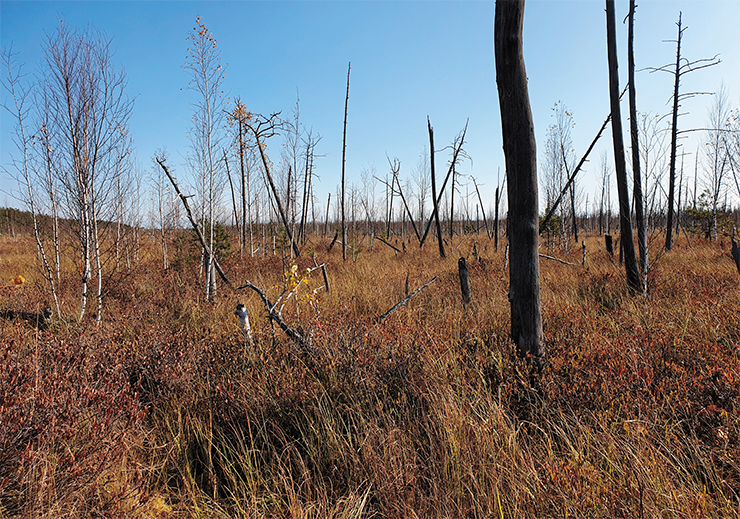
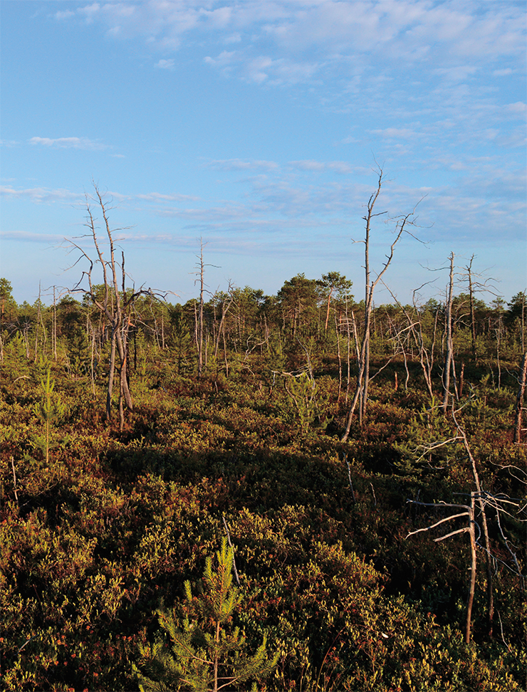
Untouched, undrained peatbogs are virtually fireproof; quite on the opposite, they serve as a natural barrier to spreading forest fires. Peat (soil) fires in natural landscapes of Western Siberia are very rare and are usually a continuation of fires in adjacent forests and meadows.
However, in the 1960’s and 1970’s, large areas of peatlands were drained in the Tomsk region as part of the forest melioration program, which, incidentally, has not resulted in the anticipated increase of the volume of marketable timber. The total area of peatlands affected by the program in the Tomsk region alone was around 67.5 thousand hectares (about 167 thousand acres) (Semenova, 2001). Peatbogs were also drained for peat mining for agricultural purposes. There used to be dozens of peat processing factories in the region; however, the developed bogs have been abandoned, and are getting overgrown by young brush, without any proper conservation and fire protection actions.

Peatland fires in the southern part of Western Siberia are facilitated by clear-cut logging, especially of birch islands of the forest – a common feature of the forest-steppe zone: small, naturally occurring stands of birch and aspen, typically occupying poorly drained depressions with peat deposits (Pologova, 2012). Logging leftovers are piled and often burned, or can catch fire spontaneously during grassland fires typical for the region – all of this can cause peat to combust even during the safe winter period.
The presence of large areas of drained and abandoned peatland in the Western Siberian Plain is by itself a risk factor for massive peatland fires accompanied by emission of large volumes of carbon dioxide. However, not long ago, scientists described changes in atmospheric circulation that radically change our understanding of this threat as applied to peatlands, and have not been a subject of broad discussion even in the academic environment (Mokhov et al., 2012; Kononova, 2014, 2015; Litvinova, 2020).
We are speaking about phenomena caused by global warming: atmospheric blockage and meridional transfer. They consist in extremely persistent high-pressure systems that stay over the affected area – atmospheric high that block cold, humid masses of Atlantic air. This results in scorching heat of Biblical proportions, and means a manifold increase in the risk of combustion of all peatlands, without exceptions!
It was this type of atmospheric blockage that caused the catastrophic peatland fires of 2010 around Moscow, when the capital city was literally suffocating from smoke (Golobov, 2010). Two years later, a similar situation occurred in Siberia, sparking numerous uncontained forest and tundra fires (Barashnikova et al., 2013; Kulikova et al., 2015).
Luckily, in 2012, despite the extended dry spell and high temperatures, Siberian peatlands did not burn massively, despite losing a lot of their moisture. However, some peatland fires in the south of the Tomsk region persisted for over a month; most of those fires were restricted to small areas between the rivers Ob and Tom.
If for some reason such blockages repeat for two years in a row, the chances of Siberian peatlands going up in flames will increase manifold. The scale and consequences of a catastrophe of such magnitude are difficult to imagine. A forest fire will eventually be extinguished by fall rains and snowfall, but peatlands can burn for years. The ramifications here go beyond excessive CO2 emissions: smoke from burning peat can travel thousands of miles, engulfing cities and villages and threatening the health and lives of people.

According to the Paris treaty of 2015, countries must retain and increase the amount of absorbers and accumulators of greenhouse gases. Long-term studies by the global scientific community prove that wetlands have a more important climatic role than forests. In 2019, the UN Environment Assembly acknowledged the global importance of peatlands and called upon the involved parties to extend regional and international cooperation, information exchange and interdisciplinary research to facilitate conservation and sustainable management of peatlands (Kirpotin et al., 2021).
The next logical step in the process involves including wetlands into the quote distribution mechanisms of the Paris treaty. This means the necessity of developing the scientific bases of extending the list of activities involved in managing peatlands as objects of the National Report on sources and absorbers of greenhouse gases. When this happens, Russia and Western Siberia in particular will gain massive geopolitical dividends. However, one must remember about the negative consequences of extensive bogging on regional levels.
The high degree of bogging of Western Siberia translates into extreme abundance of bloodsucking insects, underdeveloped road network, complications in construction and other challenges in the development of these territories. For our country, preservation of wetlands comes at a price, including financial losses. On the other hand, the costs of conservation will appear insubstantial if we remember that wetlands provide a number of ecosystem «services» critically important for the well-being of the humankind.
Noticeable climate changes became the key challenge for scientists of the XXI century; in regard to wetlands, the is a number of problems and issues that require thorough investigation.
Back in 2009, a cross-latitudinal system for landscape ecology research and all-season monitoring, including biochemical monitoring, was organized across Western Siberia. This project involves an unprecedented mega-transect spanning across 2500 kilometers from the highlands of the Altai mountains to the Siberian Arctic. In 2016, all research stations that hosted stationary studies of key plots and field experiments with natural ecosystems were included into the International Network for Terrestrial Research and Monitoring in the Arctic (INTERACT II). Two years later, the Siberian Latitudinal Mega-transect was registered as a «unique research installation of the Russian Federation».
Recently, such research project, called the Gradient of Northern Territories was launched in Canada; a historical merger of this project with its Siberian «older brother» was held in Quebec. There are plans to create an even longer (about 5 thousand kilometers/3 thousand miles) research mega-transect spanning from west to east from the Ob basin to the basin of the river Kolyma in Yakutia and including basins of mouths of the major Siberian rivers: Yenisey, Lena and Indigirka.
Such approach provides researchers with the optimal logistics tools to run several parallel connected and mutually beneficial large-scale international projects on the study of natural ecosystems. It exemplifies real integration, cooperation and interaction of scientists from different countries to study global problems that the humankind is facing.
* Mikhail Lomonosov’s famous saying, “The power of Russia will grow by Siberia and the Northern Seas”
** A Russian proverb
References
Kirpotin S. N., Antoshkina O. A., Berezin A. E. et al. How the World’s largest peatland helps addressing the World’s largest problems //Ambio. 2021. V. 50. P. 2038–2049.
Kirpotin S., Berezin A., Bazanov V. et al. Western Siberian wetlands as indicator and regulator of climate change on the global scale // Int. J. Environ. Stud. 2009. V. 66. P. 409–421.
Kirpotin S. N., Callaghan T. V., Pokrovsky O. et al. Russian–EU collaboration via the mega-transect approach for large-scale projects: cases of RF Federal target Programme and SIWA JPI Climate EU Programme // Int. J. Environ. Stud. 2018. V. 75. P. 385–394.
Litvinova O. S. The influence of macrocircular conditions on atmospheric humidification in the south and south-east of Western Siberia // Geographical bulletin. 2020. N. 2(53). P. 100–110. Doi:10.17072/2079-7877-2020-2-100-110.
Semenova N. M. Wetland conservation in Western Siberia // Ispolzovaniye i okhrana prirodnykh resursov Rossii. 2017. N. 1. P. 45–54. [in Russian].
Semenova N. M. Western Siberia in the context of global nature conservation concerns // Int. J. Environ. Stud. 2014. V. 71. P. 595–604.
Serikova S., Pokrovsky O. S., Laudon H. et al. High carbon emissions from thermokarst lakes of Western Siberia // Nat. Commun. 2019. V. 10. P. 1552.
Study of natural and climatic processes on the territory of the Great Vasyugan swamp. Novosibirsk: publishing SB RAS, 2012. 243 p. [in Russian].