Tsunami on Screen
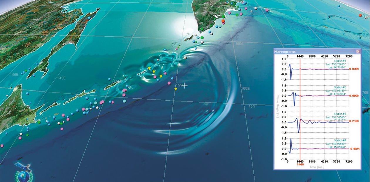
The Laboratory of Mathematical Modeling of Tsunami at the Institute of Computational Mathematics and Mathematical Geophysics SB RAS has created the geoinformation application Integrated Tsunami Research and Information System (ITRIS) aimed at supporting the research of natural catastrophes. The application is built on the principles of GIS-technology and combines databases and program components for modeling of dangerous natural phenomena along with geoinformation resources including satellite photographs, digital models of land and sea bottom, materials of remote sensing, databases on population and infrastructure of big cities.
The initial purpose of the research carried out at the Institute of Computational Mathematics and Mathematical Geophysics SB RAS was to create a convenient interactive media for working with geophysical databases and tsunami modeling. However, its facilities turned out to be much wider. In fact, we managed to create a domestic system analogous to the well-known Google Earth, equal to it in functional capabilities and in some aspects superior to this product of the world’s largest IT-company.
An important feature of the ITRIS application is the possibility to use numerical modules designed for modeling of tsunamis and other natural cataclysms. The embedded system of database management serves for sampling, visualization and processing of the data on tsunamis, earthquakes, volcanic eruptions, meteorite impacts, etc. The application also works with realistic three-dimensional models of buildings and the related information bases (for example, address and telephone books), which makes it possible to solve problems of the municipal services management.
The system can be used for visualization of not only geophysical but any other databases (for example, economic or social), bound to geography, as well as for incorporating blocks of modeling of various processes, natural or man-caused. Today, the laboratory is working at creating a block of on-line evaluation of the possible material and human losses in earthquakes. It is not a secret that the initial information from a distress area differs greatly from the final estimates, while the decision on the scale of rescue operations and necessary help to the suffering area should be taken within the first hours upon the catastrophe. It is possible to give more realistic estimates of the expected losses by integrating the modern means of modeling of the earthquake consequences with the actual data on the development and population density at the epicenter. The ITRIS application is what makes this integration possible, producing a forecast within minutes.
This product is the fruit of joint efforts of the scientists engaged in theoretical studies of natural catastrophes and experts in information technologies. A group of high-class programmers was invited to write a program of 3D visualization of geographic data and to superpose the results of calculations on them. It is expensive for an academic institution, but cooperation with companies and enterprises working on the GIS market can make the problem solvable.
Additional financial resources and a great amount of satellite images were provided by the WAPMERR agency (World Agency for Planetary Monitoring and Earthquake Risk Reduction) from Switzerland, which has a good and long-standing reputation in the field of geoinformation technologies and creation of 3D models of the world’s largest cities. Such cooperation turned out to be quite effective and mutually beneficial. The Siberian scientists gained access to the global geoinformation resources and got a chance to use modern programming technologies, and the WAPMERR agency acquired a software product using the latest developments in the natural catastrophe modeling.


