Seismic Pulse of a Volcano: An Expedition to Gorelyi
Volcanos have always been the focus of interest and sometimes even worship. The spellbinding beauty and might of volcanic eruptions inspired legends and myths, which were nothing else but attempts to interpret these astonishing natural phenomena. Even at present, the interest in volcanos is no weaker: the humanity is still vulnerable to the natural disasters caused by major eruptions. Scientists strive to understand the volcanic machinery. Such studies not only provide insight into the geodynamic processes taking place in the Earth’s bowels but also improve the predictions of volcanic events
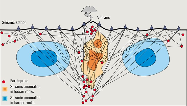
One of the ways to look inside a volcano and get a peep of its structure is seismic tomography. It is a young geophysical method, which is now extensively used for the investigation of various geologic bodies. Seismic waves produced by eruptions propagate in the Earth’s interior and illuminate it like X-rays. The task of seismic tomography is to decipher this information and construct a 3D model of elastic parameters, e.g., seismic velocities. Such a model, in turn, provides insight into the geologic processes occurring deep in the Earth.
A good-quality tomographic pattern requires the accumulation of a great deal of precise information. For this purpose, it is necessary to establish seismic networks and maintain them for long. This demands a lot of money, because a modern seismic station costs as much as a new low-cost car, and a meaningful experiment involves dozens of such stations. Another problem is to deliver heavy equipment to hard-to-access areas and install it on a volcano.
It is no surprise therefore that, in spite of the great interest in seismic tomography methods, there are few examples of satisfactorily established networks suitable for obtaining good quality seismic images of a volcano interior.
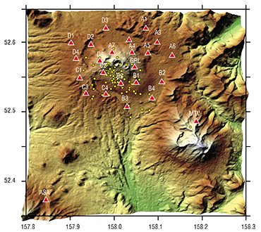
In 2013, the Laboratory of Seismic Tomography (Trofimuk Institute of Petroleum Geology and Geophysics, Novosibirsk, Russia) started an expedition to the Gorelyi Volcano in Kamchatka. Its goal was to establish a sufficiently dense network of seismic stations.
The “breathing” volcano
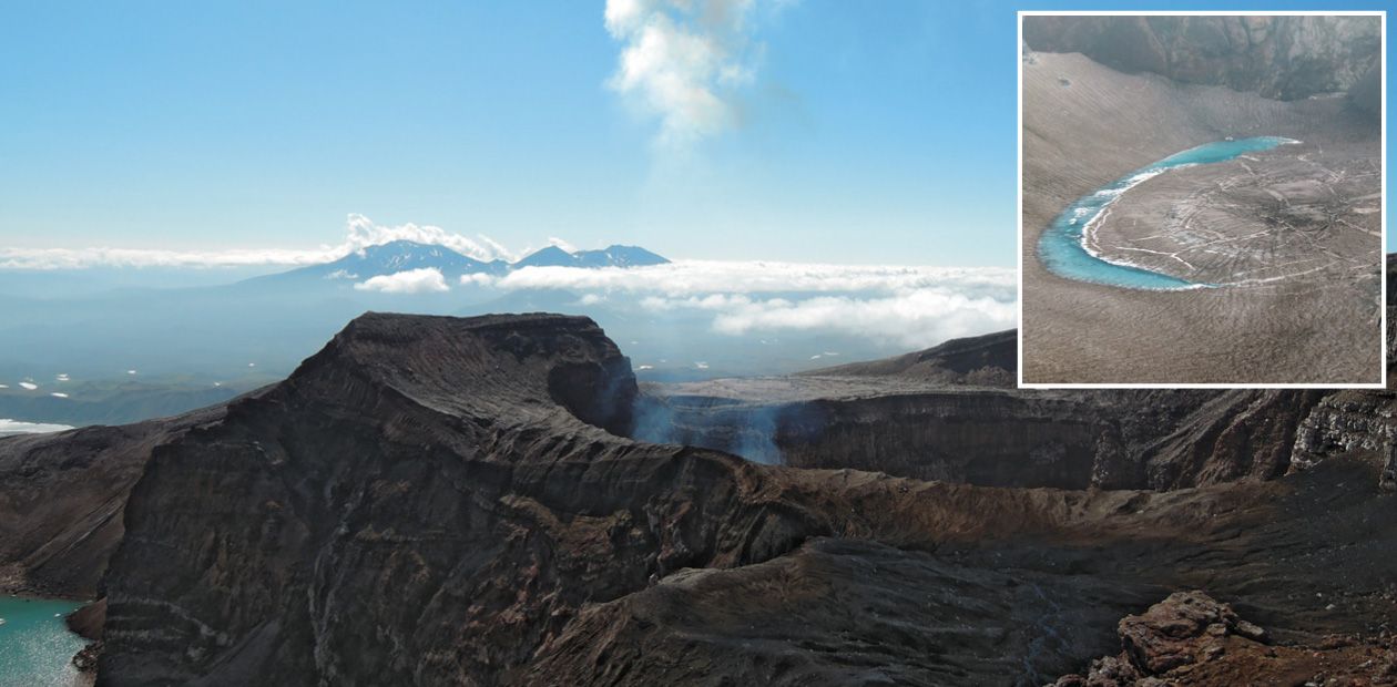
Gorelyi is among the most active volcanos in Kamchatka. It may be dangerous, as evidenced by a large caldera (huge round cuphole) about 30 km in diameter, surrounding the present volcanic edifice. This caldera formed during a violent eruption of the proto-Gorelyi volcano about 40 ka BP, a geologic yesterday.
The volume of rocks ejected in that eruption is estimated to be about 100 km3; thus, it may have produced a global climatic effect, as the Tambora eruption did in 1815. Such explosive eruptions are associated with andesitic magmas, which are highly viscous matter saturated with fluids.
Presently, Gorelyi produces regular quiet eruptions of basaltic lavas. Owing to their low viscosity, they spread gently over a large area and form a shield volcano with gentle slopes. As a rule, this mode does not cause disastrous eruptions. Nevertheless, nobody can be sure that the volcano will not change its behavior, as it did repeatedly in its geologic history.
In the last century, Gorelyi erupted regularly, though not too potently, at 20–30-year intervals. The latest eruption occurred in 1980. Its ash reached Petropavlovsk-Kamchatsky, the city located 70 km away from the volcano.
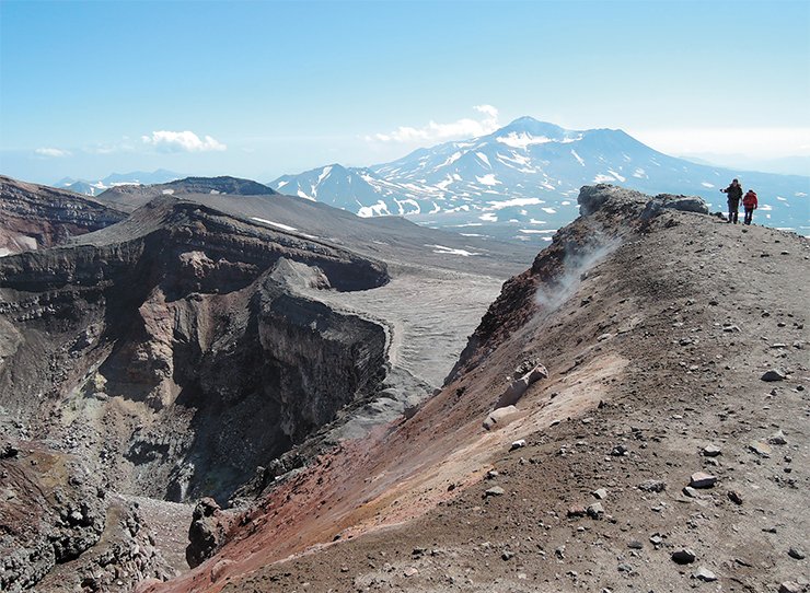
Now Gorelyi is in its activation phase: the volcanic edifice daily experiences dozens of earthquakes and long-term seismic oscillations, or tremors, are recorded. These are generally thought to be associated with matter movement inside the magma chamber. The seismic activation phase may soon give way to the eruption phase, but no accurate prediction of the development of the processes occurring inside the volcano can yet be made.
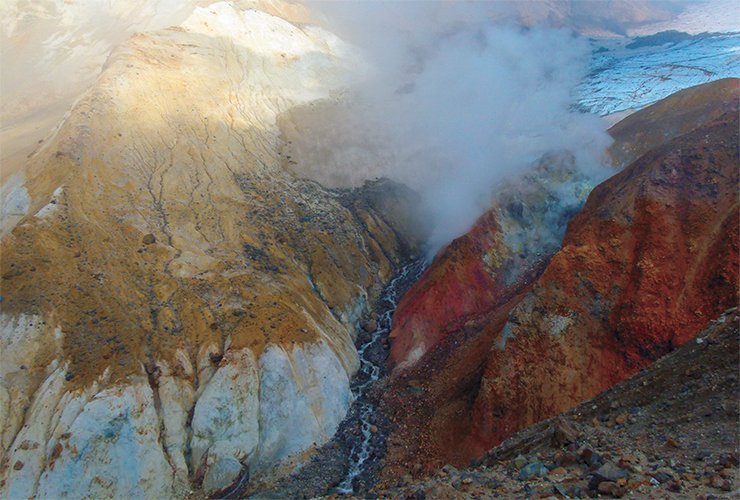
Another feature of Gorelyi is constant gas emission through the central crater. It is a grand spectacle. Gases break forth from the glowing orifice at the crater bottom, and their hiss sounds like a rocket engine. The gases rise hundreds of meters high at astonishing velocity, condense, and form clouds seen dozens of kilometers off.
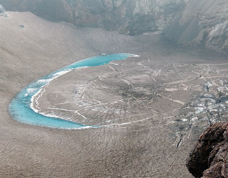
The daily amount of gases emitted from the central fumarole of Gorelyi is estimated to be 11,000 tons. This figure makes one think that probably the main product of volcanos is the constantly emitted gaseous fluids rather than effusive rocks, produced now and then. Obviously, in this regard, volcanic activity should contribute much to the atmospheric budget of the Earth. It is a different story, though.
August in Kamchatka
In spite of the interesting structure and high activity of Gorelyi, until recently the volcano has attracted less attention from geophysicists than it deserved. Before our expedition, only one permanent station had been established there, which allowed the record of seismic activity on a real-time basis but not the determination of the earthquake coordinates inside the volcano. There were two more stations nearby Gorelyi, on the neighboring volcanos Mutnovsky and Asacha. However, this network was insufficient for the comprehensive investigation of the internal structure of Gorelyi.
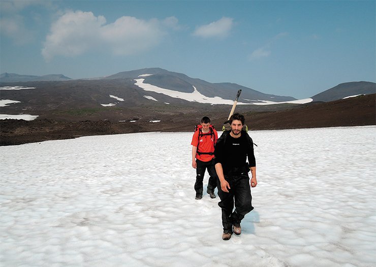
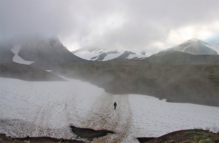
The expedition started in the summer of 2013. The base camp was at the caldera bottom at the volcano foot. The site was a deserted windswept valley. The soil was highly porous there, and all water coming from glaciers immediately soaked in. So there was no water source near the camp, and drinking water was brought to us in barrels. To have a wash, we went to the bottom of snowfields, where small pools could be found. Hydrotherapeutic procedures taken in strong wind and at temperatures slightly above 0°C were highly exhilarating. Despite the uneasy living conditions, the previous broad experience of all the members of the team and proper housekeeping made the camp quite livable.
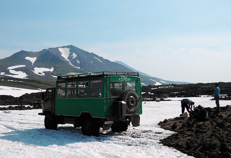
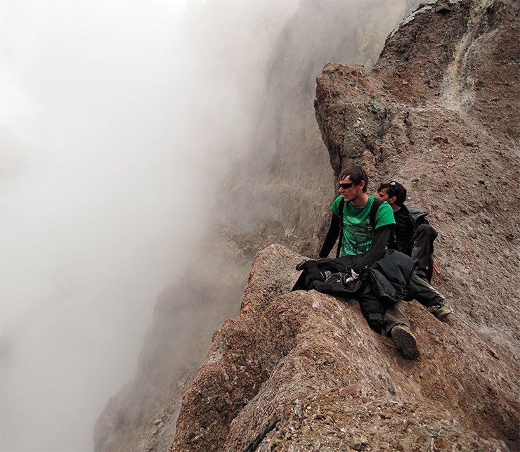
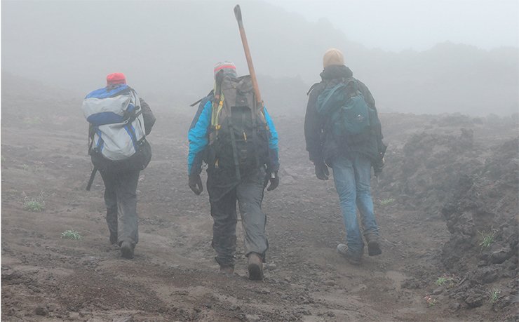
Stations were set both on the volcano slopes and outside the caldera regardless of the weather: strong winds, fog, rain, dust storms, and other delights of August in Kamchatka were ignored.
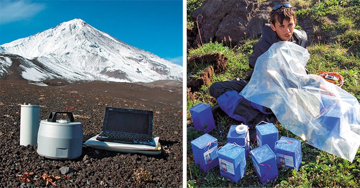
The caldera bottom was passable by a vehicle, but we had to continue on foot for 3–4 km across broken country with heavy weights aback. The backpacks contained all the components of a seismic station plus a computer, digging tools, heat-insulating oakum, and other stuff required for installing stations.
 A seismic station consists of three main modules. First, a sensor. To put it simply, it is a very sensitive microphone, which receives the vibrations of the Earth’s surface at low frequencies, e.g., with periods up to 50 s. Second, a recorder. It digitizes signals from the sensor and records them to a memory card. Third, power supply units. Abroad they often use solar or wind generators, but they do not work in Kamchatka because of strong wind and abundant snowfall. For this reason, we used special high-capacity batteries. Forty kilograms of batteries is sufficient for one year of the station operation.
The equipment was buried deep to protect it from frost, which was hard given the stony ground of the volcano. However, the devices were even more endangered by vandals, both two- and four-legged. A few permanent geophysical stations set in hardly accessible places were completely crushed despite the concrete walls and armored doors. The malefactors utilized autogenous welders brought across roadless areas. As a rule, nothing was stolen, but costly research instruments not applicable in ordinary life were broken to pieces.
VOLCANIC METAMORPHOSESLong-term seismic observations allowed the construction of a 4D tomographic image of the crust beneath the volcanos of the Klyuchevskaya group in the central area of Kamchatka and tracing of its alteration at various eruption steps. It was found that the main magma provenance beneath Klyuchevskaya, located below 24 km, remained unchanged throughout the observation time. The above formations were notably modified by migrating fluids and melts.
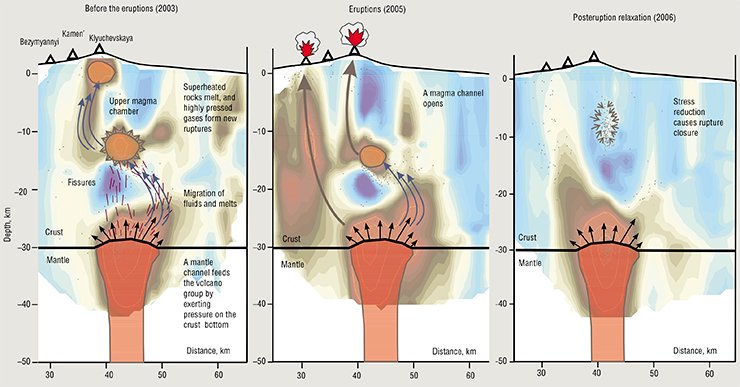
Before the major eruptions of the Klyuchevskaya and Bezymyannyi Volcanos, there were two bodies beneath them showing abnormally high ratios of the velocities of longitudinal and transverse waves (VP / VS). They were located one above the other, at the depths of 1 and 12 km, respectively. These anomalies reflect the presence of intermediate magma chambers. Their existence is proven by the petrological data on the diversity of compositions and modes of the eruptions of Klyuchevskaya group volcanos.
The eruption altered profoundly the crust structure beneath the volcanos. The pattern of seismic anomalies changed, and the mean VP / VS value increased. This observation suggested that the eruption was accompanied by an enhancing migration of fluids and melts, which saturated rocks beneath the volcanos.
The mean VP / VS value decreased within three years after the eruptions, and the anomalies in the upper part of the crust vanished. This points to the relaxation phase of the volcano, when the amount of fluids in the system is insufficient to form magma chambers.
The results show that magma chambers are dynamic systems. Probably, they consist of porous matter with superheated rocks close to the melting point. The influx of fluids from the mantle decreases their melting temperature, resulting in partial melting and magma chamber formation. However, if the fluids come to the surface during volcanic activity, the molten substance can rapidly disappear from the magma chambers
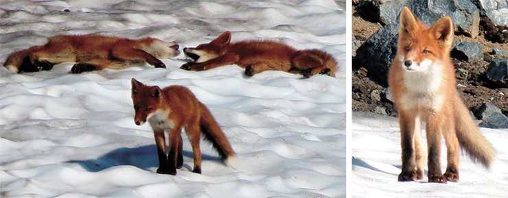
Bears, abundant in Kamchatka, are another hazard. They evince great curiosity and interest in humans. Sometimes, bears devastated stations immediately after they had been set up, and a full repair was required. It is for this reason that it is recommended to refrain from eating, easing oneself, or leaving any traces that would point to human presence at the site. Fortunately, in August bears kept aloof from people, although we always felt that they were somewhere nearby.
It took us ten days of hard work to put into operation all the new stations, but the departure was postponed. On the last day of the installation, we received information that seismic activation of the volcano began, which appeared as hundreds of subtle but discernible earthquakes per day. The opportunity to obtain unique data rapidly was not to be missed, so we spent a three-day holiday at the volcano bottom, while all the stations were simultaneously recording seismic processes.
During field work, Novosibirsk scientists, supported by the Institute of Volcanology and Seismology, Far East Branch of the RAS, set 21 seismic stations in addition to the older one. In terms of its location and tooling, the seismic network covering the volcano is among the world’s best.
The new network has already produced information on hundreds of seismic events on the volcano, which will be used to localize the magma chamber. Based on these data, of a tentative tomographic image of the volcano is to be constructed in the nearest future.
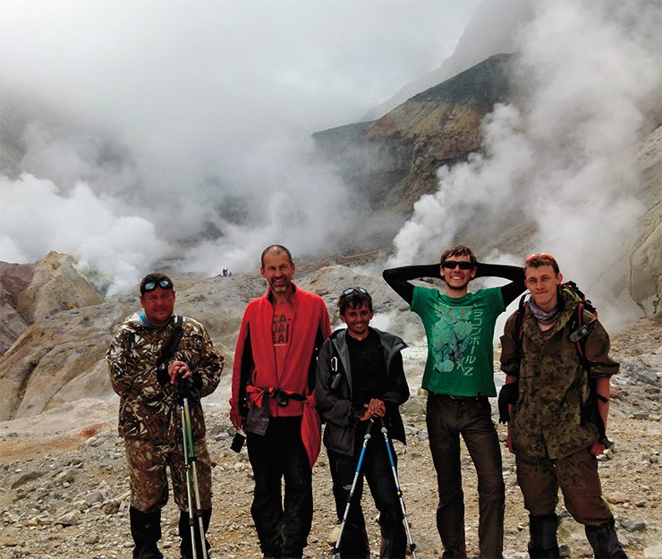
The bulk of the data will be obtained in August 2014, and then the equipment will be withdrawn. It is believed that the records obtained during the year of the network operation will provide comprehensive information on the functioning of the magmatic system and allow estimation of the probability of its activation in the future.
References
Koulakov I. LOTOS code for local earthquake tomographic inversion // Benchmarks for testing tomographic algorithms. 2009. BSSA. V. 99, N. 1. P. 194—214.
Koulakov I., Gordeev E. I., Dobretsov N. L., et al. Rapid changes in magma storage beneath the Klyuchevskoy group of volcanoes inferred from time-dependent seismic tomography // J. Volcanol. Geotherm. Res. 2013. V. 263. P. 75—91.
This work was supported by the Department of Earth Sciences of the RAS, project 7.3; Siberian Branch of the RAS, Integration project 20; and Integration project 42 of the Siberian and Far East Branches of the RAS


