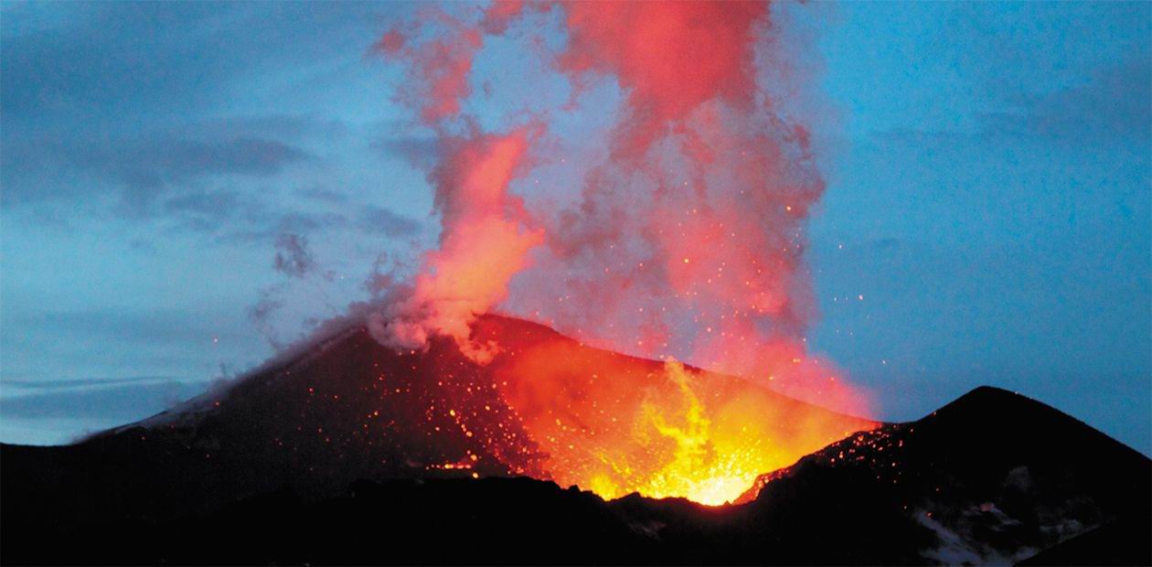
Tolbachik Eruption – another message from the Land of Volcanoes
The majority of volcanic eruptions and earthquakes on our planet occur along the so called Ring of Fire – a chain of over five hundred dormant three hundred active volcanoes lined up along the perimeter of the Pacific Ocean. The reason is that this area lies on the junction of oceanic and continental tectonic plates, and volcanic activity is directly linked with their incessant interaction in the ongoing process of continent drift. The Pacific Ring of Fire (or rather, an arc) stretches along the oceanic coast of North and South America, the Antarctic, continues across New Zealand, Philippines and Japan, and reaches the Kurils and the Kamchatka peninsula. The latter is called the Land of Volcanoes for a good reason, and the Klyuchevskaya group of volcanoes on Kamchatka is truly a volcanic sanctuary. The eruption of the Tolbachik volcanic massif of 2012-2013, considered among the largest eruptions globally, was yet another bright manifestation of the volcanic activity in the area. Luckily, unlike the eruptions of many of its’ Pacific “brethren”, it caused no casualties, but held quite a few surprises for its researchers
“The Tolbachik mountain stands in the wedge between the Kamchatka river and Tolbachik and has been smoking since long ago; at first, the kamchadals say, the smoke came from its top, but after 40 years this changed, and the mountain began to burn on the ridge that joins it with another mountain. In the beginning of 1739, it was the first time it spewed a kind of a fireball, which burnt out all forest in the adjacent mountains. After the fireball came a kind of a small cloud, which spread with time and settled, thus covering the snow with ash for fifty versts in all directions” (Krashennikov, 1755). This is what Stepan Krashennikov, a renowned Russian researcher and traveler, writes about the volcanic activity of Ploskiy Tolbachik in his classic work, The Description of the Land of Kamchatka [“Opisanie zemli Kamchatki”]. Beginning from the mid‑1700’s, another dozen of eruptions of different magnitude were recorded in the Tolbachik volcanic massif; the majority of these eruptions occurred in the XX century.
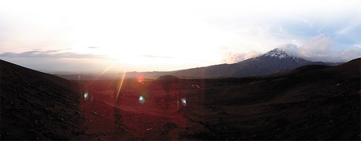
The last episode of volcanic activity in the XX century was recorded in 1975—1976. It was a powerful eruption, unanimously declared to be so outstanding that it even got a proper name: the Major Fissure Eruption of Tolbachik, or MFET (Russian: Bolshoe treshchinnoe tolbachinskoe izverzhenie, BTTI) (Fedotov, 1984). The latest eruption, which began 36 years later, in 2012, merited the same honor and was named the Tolbachik Fissure Eruption of the 50th Anniversary of the IVS, or TFE‑50 (Russian: Tolbachinskoe treshchinnoe izverzhenie imeni 50-letiya IViC (TTI 50) on the occasion of the anniversary of the Institute of Volcanology and Seismology of the Far East Division of the Russian Academy of Sciences in Petropavlovsk-Kamchatskiy.
One must note that the last (and the preceding) eruption of Tolbachik was not unique as such, as events of this kind occur all over the planet: Iceland, Ethiopia, the Hawaii… During these eruptions, a crack, or fissure, appears in the earth surface, and vast volumes of lava pour out. For this reason, the Tolbachik volcano is called a Hawaiian-type volcano, and such eruptions are called fissure eruptions (Fedotov, 1984). And yet, this eruption was by no means a usual one. The thing is, fissure eruptions are usually connected with the so-called hot spots, or plumes. The latter are streams of deep molten matter, which rise through the mantle and reach the surface, burning through the lithosphere and emerging as volcanoes with very hot, fluent basalt lava.
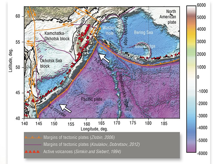
In general, all volcanoes can be divided into two types. Volcanoes of the first time are connected with plumes, and their activity pours the mantle matter onto the surface of Earth. Volcanoes of the second dype are formed in the so called subduction zones, in a process where one tectonic plate submerges beneath another. These subduction areas are characterized by a number of complex chemical, mechanical and thermal processes. This results in massive volumes of water, fluids and molten matter rising towards the surface and emerging as chains of volcanoes – the volcanic arcs. There is also a third type of volcanoes, also quite widespread, connected with the eruption of basalts in mid-oceanic ridges. Iceland is a vivid example, although it is, in a way, an exception: most of eruptions of this kind occur deep underwater and are inaccessible to direct study.
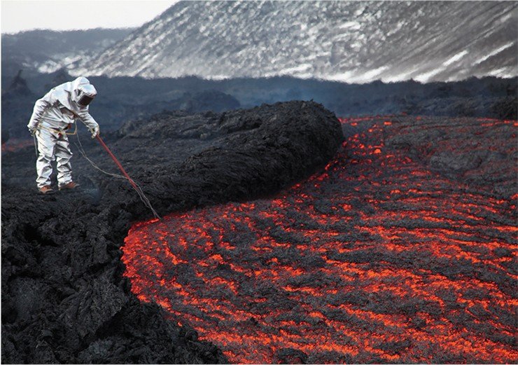
A peculiar feature of Tolbachik is its lavas: their composition is closer to plume lavas, and the volcano is situated in a subduction zone! Fissure eruptions of this sort are truly unique. Another remarkable feature of Tolbachik is its location, right in the middle of the Klyuchevskaya volcanic massif, which is called the Volcanic Sanctuary for a good reason. It includes all types of volcanoes found of earth with strikingly unique forms and a variety of eruption modes.
WHAT FEEDS TOLBACHIK? What powered the most recent eruption of Tolbachik? Detailed study of the internal structure of the crust and mantle based on long-term non-stop seismic monitoring of the Klyuchevskaya volcanic massif allowed us to build a subduction model for this region, where two tectonic plates interact – the Pacific plate and the so-called Okhotsk Sea plate, which is a part of the Eurasian continent (Koulakov et al., 2011).The oceanic plate, submerging into the mantle beneath Kamchatka, the Kurils and the Aleutian islands at a speed of 7.5 to 8.2 cm per year, melts at the depth of 100—150 km. How does this work? While still under the ocean, the plate is saturated with large amounts of various materials, including organic matter and water. When the plate sinks deep into the mantle, these substances are exposed to great pressures and temperatures and begin transforming and erupting from underneath the plate. The material emerges gradually, in batches, and the whole process is accompanied by seismic events. When water emerges from underneath the plate, it lowers the friction, and with the high pressure at these depths, the plate becomes “slippery”. Hot material rises, and instead of a uniform wall, it forms discrete streams at intervals of around 100 km (Dobretsov et al., 2001). This leads to the emergence of typical volcanic groups on the surface at the same intervals. It looks like one of such streams, located underneath the Klyuchevskaya volcanic group, is feeding Tolbachik, among other volcanoes
The main active volcano of the massif, the Klyuchevskoy volcano, is one of the largest in Eurasia; it erupt relatively small and uneventful streams of basalts lava, which, in the hundreds of thousands of years of its activity, have formed a nearly perfect enormous cone. The Bezymyannyi volcano (Russian for “nameless”), located in ten kilometers, is radically different in its eruptions characteristics and contents. It was dormant for several thousand years until the middle of the XX century, which explains its name, but in 1956, a catastrophic explosive eruption occurred – one of the largest in the century. It has been erupting almost annually ever since; these explosions may not be as catastrophic, but they are still rather substantial. The fissure volcanism of the Tolbachinskiy Dol (a. k.a. the Tolbachik Valley) is still completely different from the two types above.
Overall, there are over ten major volcanoes in the massif. Many are considered dormant, yet every now and then one of them “wakes up”. For instance, in 2018, increasing seismic activity was recorded near the Udina volcano, which had been considered extinct. This activity may not necessarily be a warning sign of a forthcoming eruption, yet it mean that the magmatic streams beneath are alive, thus driving researchers’ attention on the volcano.
Sensors catch the eruption
The Tolbachik eruption of 2012—2013 caught researchers by surprise. Its preliminary stage was essentially different from the previous major eruption of 1976, which developed gradually. Back then, first, a series of powerful seismic shocks were registered, which became exponentially more and more frequent. The process culminated on July 6, 1975, when fissures 200 to 600 meter long opened, and immense volumes of lava began to pour out. In the following two months, new fissures kept forming, gradually shifting south. Lava outflows began in the Northern Vent area, in about 15 kilometers from the peak of Ploskiy Tolbachik; eventually, another effusion location appeared, 25 kilometers to the south – the Southern Vent.
With the last eruption, the warning signs were not as clear, which made it impossible to predict the beginning of the eruption. Later, detailed examination of seismic data revealed a raise in the number of seismic events in the preceding months, which, however, failed to alert the scientists because of their extremely low magnitudes (Kugaenko et al., 2015). It was only in the day before the eruption, which began on November 27, 2012, that earthquakes strong enough to raise concern were registered, caused by the the magma breaking through the earth surface. Since Tolbachik stands in a scarcely populated area, we recorded the beginning of the eruption precisely because these events were registered by the seismic stations of the Kamchatkan division of the Geophysical Service of the Russian Academy of Sciences, which were constantly transferring real-time data to the central office in Petropavlovsk-Kamchatskiy.
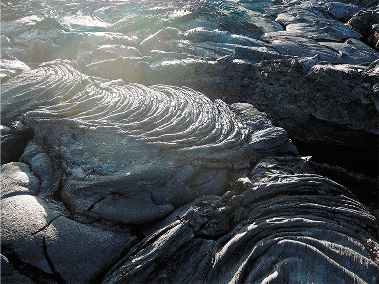
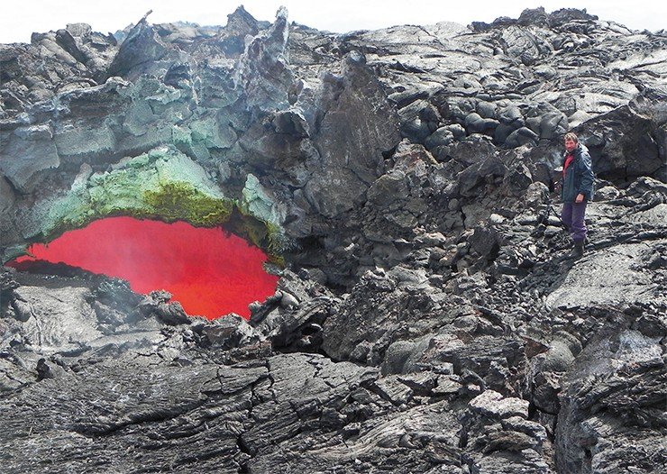
In the next few days, massive explosions accompanied the eruption, their roar audible in settlements 30 to 50 kilometers away from the site. Ash from the explosions traveled great distances. Lava streams poured from several orifices at once, spreading for tens of kilometers. They posed no danger, and not only because of the remoteness of the area: in reality, lava stream rarely take lives, and most casualties are careless bystanders whose curiosity drives them into the scorching trap. The most dangerous things in eruptions are pyroclastic streams, made of a mixture of extremely hot volcanic gases, and lahars – shooting flows of mud flowing down the volcano slopes at great speed. But phenomena of this kind do not occur on Tolbachik.
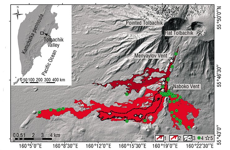
Immediately after the “discovery” of the eruption, scientists of all kinds rushed to Tolbachik. Despite the harsh weather conditions – a typhoon which had brought a blizzard – the Institute of Volcanology and Seismology organized complex non-stop observation of the eruption. It turned out that this time, lava erupted through two vents located on the southern slope of Ploskiy Tolbachik approximately 5 and 8 kilometers away from its top. These vents were named after two famous Russian volcanologists – I. A. Menyaylov and S. I. Naboko. The vents were located closer to the cinder cone of the volcano that the Northern and Southern vents, where massive volumes of lava erupted in 1975—1976.
In addition to seismological research, Tolbachik was studied in a variety of ways, including geodetic, petrological, and geochemical surveying. Among other things, geochemists discovered that basalt from different lava streams, similarly to the 1975 eruptions, contained markers pointing at the heterogeneity of the erupted magma (Churikova et al., 2015). This was an essential discovery, meaning that there can be isolated “hot pots” 30 kilometers beneath the surface, “cooking” their magma differently. However, it was also possible that the contents of the lavas changed as they approached the surface due to chemical and mechanical interactions with the very heterogenic material of the crust. In this sense, it was especially interesting find out whether all lava vents were fed by the same or different deep magmatic pools and whether they were connected with sources underneath other volcanoes, such as Klyuchevskiy and Bezymyannyi.
A geophysicist’s view
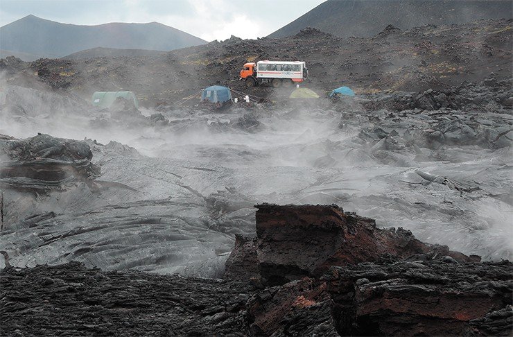
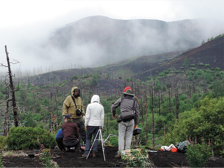
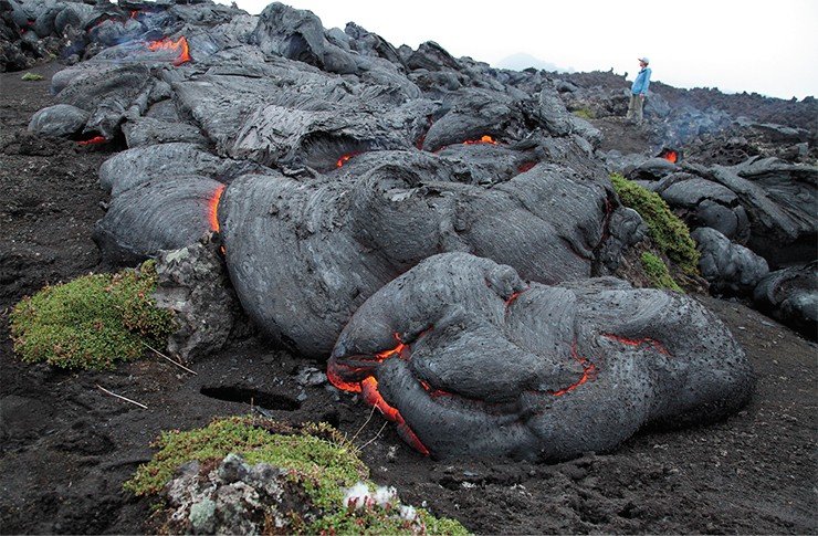
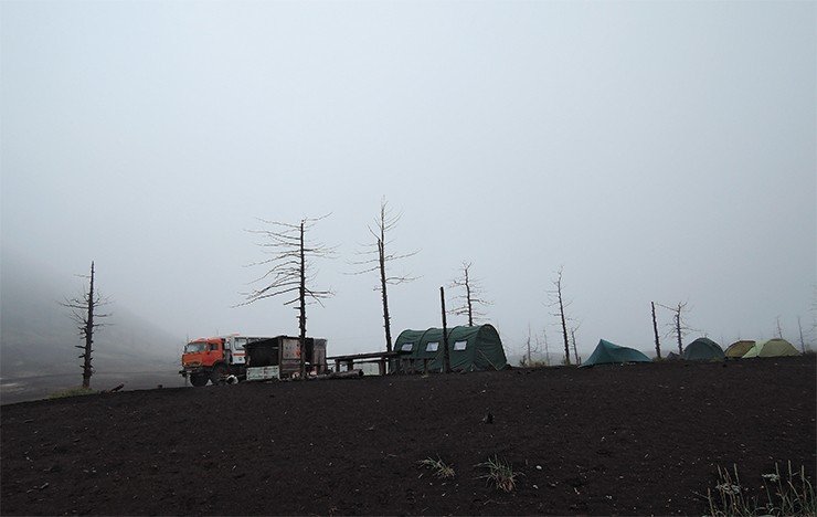
We came to Tolbachik about a year after the eruption. Why didn’t we go there right away? It’s not easy to organize an expedition of this scale, and installing geophysical stations in the middle of eruption is useless: the place was so raw and “noisy” that we would not be able to retrieve any information on the volcano’s deep structure. When we arrived, the lava had almost hardened, but it was still very hot and sizzled under the rain. We set up twenty stations, and the FEB RAS Volcanology and Seismology Institute together with the Kamchatkan Division of the RAS Geophysical Service provided four more stations.
In the result, we achieved a dense and uniform network of almost thirty stations. Actually, few researchers ever set up seismic stations on volcanoes – usually, they are installed in easy-to-reach locations with road access. It is difficult to create a uniform network, but in this manner we can obtain unique, high-quality data.
As a matter of fact, before that, there were only two seismic stations in the vicinities of Tolbachik, which could only register the fact of the earthquake as well as its center with an approximation of 5 to 10 kilometers. It was virtually impossible to pinpoint the quake depth precisely. Our new network allowed us to collect the necessary data which were eventually used not only for precise location of seismic sources but also for building a seismotomographic model of the volcano (Koulakov et al., 2017).
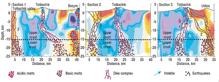
 Underneath Tolbachik, we found several zones with lowered speeds of seismic waves, which are usually connected with areas of elevated temperatures and/or saturation with fluids and molten matter. Using this information, we defined that there are at least two vertical channels underneath Tolbachik feeding the volcano. One channel is directed northwards; it is possible that it feeds the volcano from the same source as Klyuchevskoy and Bezymannyi volcanoes. The second channel, located using a seismotomographic model in the area of Tolbachik valley, leads to a completely different deep magmatic source. This explains the considerable difference of the lava contents of the peak eruption, South Vent, and North Vent.
Unfortunately, we were unable to install the stations near the South Vent during our first visit. However, a year later we installed a network which covered the whole area around the volcano, and we are about to finish processing the data now. This means a great amount of monotonous, routine work: it takes several days to process data from a single earthquake, and we need hundreds, if not thousands of such earthquakes.
The first research papers on the eruption in the Tolbachinskiy volcanic massif were published in the Journal of Volcanology and Geothermal Research in 2015. They described the eruption process and provided data of geochemical analyses, however, it was a merely a set of isolated articles. L. Dobretsov and E. Gordeev, RAS academicians, decided to compile a special volume to provide a comprehensive overview of the unique eruption. Tolbachik Fissure Eruption of 2012—2013 (TFE‑50), published in the end of 2017, contains a detailed account of the eruption and the peculiar features of the Kamchatkan subduction zone, where Tolbachik is located. It traces back the geological history of the region, which stipulates the diversity of volcanic types on Kamchatka, including the Klyuchevskaya massif. In addition to the description of the eruption process and seismological data, the monograph presents detailed information on the structure of the crust beneath the volcano, the chemical contents of its lavas and volcanic gases, and the diversity of rock types and mineral associations in the erupted material. This information serves as a basis for evaluating the peculiarities of lava formation in deep sourcesOur colleagues from the Kamchatkan Division of the RAS Seismic Service have done an outstanding job studying the deep structure beneath Tolbachik. They have used another method – the microseismic probing. The thing is, the surface of Earth is constantly vibrating due to microseismic events, ocean surf and other factors. The amplitude of these oscillations registered on the surface depends on their deep structure. This effect is well illustrated with a fast river in the mountains. If there is a huge boulder at the river bottom, a large, stationary wave forms on the surface, called a sheet flow wave. If ther boulder is deep underwater, the wave will have a smooth contour; if it is close to the surface, it will have an acute “peak”. The same applies here: if we examine the seismic station records and see high amplitudes of background noise oscillations, that means that there is a body below with low seismic speeds. The analysis of the amplitude of seismic oscillations registered on the surface allows the evaluation of the depth and shape of the anomaly.
Data acquisition for microseismic probing requires tedious fieldwork. The study area is marked with a dense grid. Researchers install the device in each node of the grid and record the signal for several hours, until they have completed the observations. Such work can take several months in the fields. The important thing here is that two independent geophysical methods based on seismotomography and microseismic probing have yielded essentially the same results and indicated the presence of feeding channels underneath Tolbachik with similar configuration.
All major subduction zones are located around the Pacific Ocean (in Japan, New Zealand, Phillipines, and the Americas) and in Indonesia. All these are densely populated areas. Extremely skilled volcanologists and seismologists work there, and their work is literally a matter of life and death, because modern technologies allow to predict, what and when will happen.
Unfortunately, the level of volcano monitoring and public warning is not always satisfactory. For instance, the last eruption of the Fuego volcano in Guatemala in June 2018 caused pyroclastic streams and catastrophic lahars, which killed dozens. Numerous video and photo records of the tragedy show that people often fail to take the danger seriously, which is one of the main reasons of casualties.
![Monograph: The Tolbachik Fissure Eruption 2012–2013 (TFE-50) / ed. by E. I. Gordeev, N. L. Dobretsov. Novosibirsk: SB RAS, 2017. 421 p. ISBN 978-5-7692-1551-1. [in Russian] Monograph: The Tolbachik Fissure Eruption 2012–2013 (TFE-50) / ed. by E. I. Gordeev, N. L. Dobretsov. Novosibirsk: SB RAS, 2017. 421 p. ISBN 978-5-7692-1551-1. [in Russian]](/files/medialibrary/6e7/6e7278cb84cd1fc4d02382a56316e3e5.jpg) But there are other examples as well. For instance, during a powerful eruption of the Merapi volcano on Java in 2010 the forecast played the key role in saving the population: scientists insisted that hundreds of thousands of people be moved from the potentially dangerous area around the volcano in the radius of several tens of kilometers. The calculations turned out to be true: pyroclastic streams rushed through the evacuated regions, never reaching any populated areas. If not for the volcanologists, the death toll could reach tens of thousands! The scientists were praised as national heroes of Indonesia, and people are wearing t-shirts with their portraits. So, a volcanologist is an important profession, which helps to avoid catastrophic casualties.
But there are other examples as well. For instance, during a powerful eruption of the Merapi volcano on Java in 2010 the forecast played the key role in saving the population: scientists insisted that hundreds of thousands of people be moved from the potentially dangerous area around the volcano in the radius of several tens of kilometers. The calculations turned out to be true: pyroclastic streams rushed through the evacuated regions, never reaching any populated areas. If not for the volcanologists, the death toll could reach tens of thousands! The scientists were praised as national heroes of Indonesia, and people are wearing t-shirts with their portraits. So, a volcanologist is an important profession, which helps to avoid catastrophic casualties.
In this sense Tolbachik and the Klyuchevskaya group of volcanoes as a whole is a perfect research ground: the area is virtually uninhabited, and eruptions pose little or no danger to humans.
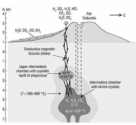
So, what has the complex study of the Tolbachik eruption yield, science-wise? As a geophysicists, I am in no position to draw any definitive conclusions about geochemistry and petrology. Eruptions in subduction areas are known to be extremely variable, and the erupted matter passes through continental-type crust, which is extremely heterogeneous in terms of its contents. The chemical contents of lavas also depend on the location of the magmatic chamber: whether it forms in the upper or lower crust or the mantle. I can only remark that the discovery of microdiamonds on Tolbachik became a true sensation, even though the opinions of researchers on their origin differed. As for geophysics, I will say it again: it was the first time we were able to create a seismotomographic model of the volcano, which vividly demonstrated its multi-chamber nature.
Continuing our work, in the summer of 2017 we installed a seismic network on the Bezymyannyi volcano, which will be dismantled in 2018. In December of the same year, we were lucky to catch an exlplosive eruption there, accompanied by a discharge of volcanic ash over 10 kilometers up into the atmosphere and by pyroclastic streams. Luckily, our stations were unharmed, as the pyroclastic stream passed in just a hundred meters away from it. We hope that the material collected with these station will yield unique information on the accumulation of the explosive force within the volcano during the eruption. This time, we will work in closer collaboration with the petrologists who will be able to examine the process from the point of view of the formation of rocks.
In addition, in the summer of 2018 we are planning to install a dense seismic network on the Avachinskiy volcano, situated directly near the city of Petropavlovsk-Kamchatskiy, thus posing a direct threat. But this is another story. As for Tolbachik, it can be a good thirty years before it erupts again, although… who knows? Eruptions, just like other natural disasters, are still immune to long-term predictions.
References
Churikova T. G., Gordeychik B. N., Iwamori H. et al. Petrological and geochemical evolution of the Tolbachik volcanic massif, Kamchatka, Russia // J. of Volcanology and Geothermal Research. 2015. V. 307. Р. 156–181.
Dobretsov N. L., Kirdyashkin A. G., Kirdyashkin A. A Deep Geodynamics. 2nd ed., ext. and rev. Novosibirsk: Publishing House of SB RAS, 2001. 409 p. [in Russian].
Koulakov I., Abkadyrov I., Arifi N. Al. et al. Three different types of plumbing system beneath the neighboring active volcanoes of Tolbachik, Bezymianny and Klyuchevskoy in Kamchatka // J. Geophys. Res. Solid Earth. 2017. V. 122. N. 5. P. 3852–3874. doi:10.1002/2017JB014082.
Krasheninnikov S. P. Description of the Land of Kamchatka. St. Petersburg, 1994. V. 1, 2. [in Russian].
Kugaenko Y., Titkov N., Saltykov V. Constraints on unrest in the Tolbachik volcanic zone in Kamchatka prior the 2012–13 flank fissure eruption of Plosky Tolbachik volcano from local seismicity and GPS data // J. of Volcanology and Geothermal Research. 2015. V. 307. Р. 38–46.
Kulakov I. Yu., Dobretsov N. L., Bushenkova N. A., et al. Slabs’ Form in Subduction Zones Under the Kuril-Kamchatka and Aleutian Arcs According to Data of Regional Tomography // Geology and Geophysics. 2011. V. 52. N. 6. P. 830–851. [in Russian].
The Large Tolbachik fissure eruption. Kamchatka. 1975–1976 / ed. by S. A. Fedotov. Moscow: Nauka, 1984. 637 p. [in Russian].
The authors and editors are grateful to A. B. Belousov, PhD, Doctor of Geological and Mineralogical Sciences (FEB RAS Institute of Volcanology and Seismology, Petropavlovsk-Kamchatskiy) for kindly providing the photographs for this article


